Next up in the Power BI Freebies series is Crime Stats by Local Government Area in Victoria.
Data from Crime Statistics Agency, 2019
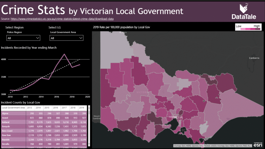
The map is a high level overview of Crimes by Local Government Area. As you can see no matter how you look at it overall Crime is on the up compared to 2010. In a latter blog we will find out what type of crime.
This is using the ESRI map which already has the boundaries correctly labelled. One downfall of the ESRI map is that when you publish it to the web it doesn’t work, hence why you cant interact with it below. I would recommend using the Mapbox visual which doesn’t have this issue but does require you to import your own shape file. As you are getting the pbix it was much quicker to just use the ESRI. Feel free to download below and interact.

Hope you have enjoyed this post. Are you are interested in how you can create something like this from scratch in an hour? Check out my Power BI Training for Government – One Day Intensive, which is on in Melbourne next week.
Cheers,
One thought on “Victorian CrimeStats Analytics in Power BI”
Hey Warren, I have been already following you on LinkedIn and that is how I came on your site. I downloaded and gone through the report. I am liking it. To date I didn’t get any requirement for using ArcGIS maps, but after looking at the one in your report, I will definitely demo this map to my clients. And yes, I liked the dark background!
Comments are closed.